Interactive Art Final Project Proposal
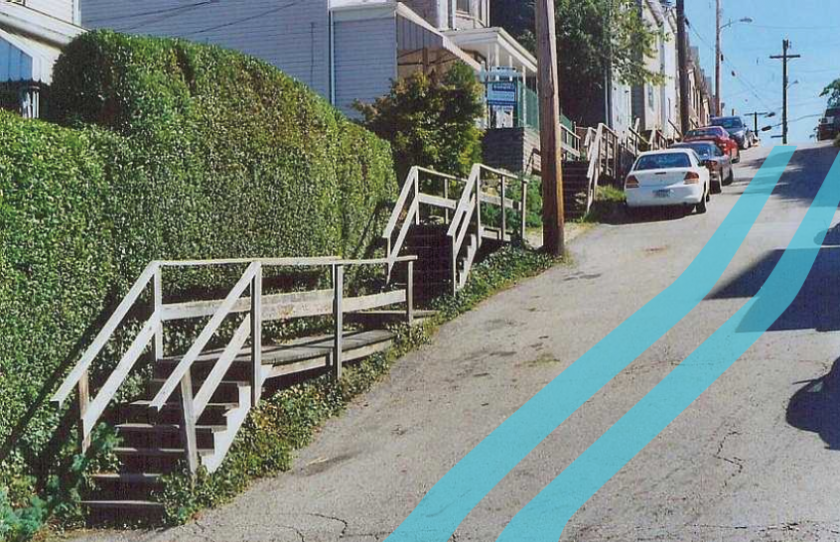
I propose to complete my watershed visualization project that I began but did not critique for Project 2. My project’s conceit is to generate a line in AR that visualizes the flow of water out of the given Pittsburgh watershed that you are standing in. It might look something like this:
As I’ve gotten feedback about this project, I’ve come to some important insights:
- Watersheds are interesting because they contain themselves: A watershed is an area in which all the water flows to one point. The Allegheny and the Monongahela watersheds are a part of the Ohio watershed, which is a part of the Mississippi. What areas are too small to be watersheds? Where does this cycle end?
- It’s important to connect this visualization to actionable information about protecting our watersheds. A raw visualization is interesting, but not enough to affect change.
- Some aspects of the visualization can be connected to the viewer so that it feels more actionable. For this reason, I think it’s important that the visualization is grounded in the way that water flows from the point the viewer is standing on, as opposed to defining the borders of the watershed more generally. In this way, the viewer might understand their impact on their environment more easily.
My technical accomplishments so far:
- I have built an AR app to iPhone.
- I have loaded the Mapbox SDK in Unity, and I can represent my current location on a zoomable, pan-able map.
- I have loaded the Watershed JSON data from an API, and can represent its geometry on the Mapbox map.
What I still need to do:
- Draw a line of best fit, representing the flow of water, through the watershed containing the viewer’s current location, and add some randomness to it so that it’s a squiggly line, but still within the real bounds of the watershed.
- Draw a line that connects the current location of the viewer to this line of best fit through their watershed, and add some randomness to that.
- Create an AR object pointed in the direction of that line.
- Model that AR object so that it appears to be a line on the groundplane.
- Model that AR object so that it extends in the direction of the line, and curves based on the curves of the line, at approximately the appropriate distance from the viewer.
- Test so that the line can be followed and updates accordingly.