What is your neighborhood made of?
Why does it feel the way it feels? What neighborhoods will “feel” similar? A lot of this is just due to what’s in it: how much of the land is dedicated to roads, how much is green space, and how much is buildings.
We don’t interact with zoning or construction in our everyday lives. We just know that some places are more pleasant than others. We don’t really see the effects of dedicating half our space to parking lots and roads. We sort of know that New York is denser than suburban Ohio, but how dense is it?
Roads Greenery Buildings is an attempt to partially answer that question.
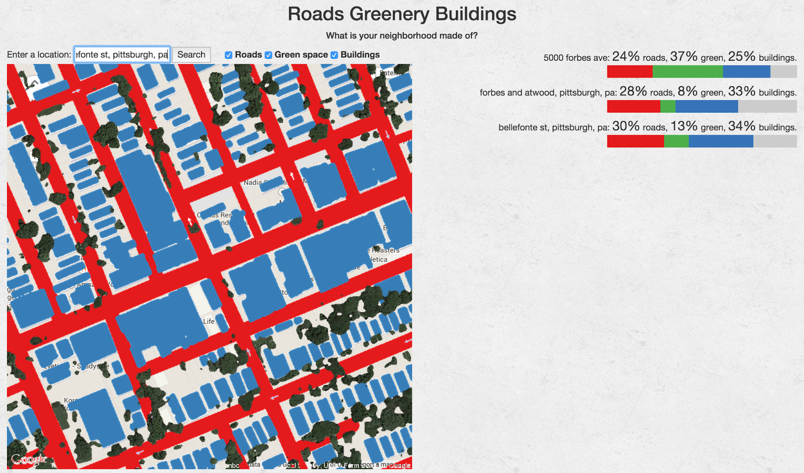
Give it an address, it will look up the place on Google Maps and Google Earth, and tell you the approximate amount of that place’s nearby area that’s taken up with roads, green space, and buildings. You can look up a few places to compare. Here we see that my neighborhood (the third one) has more roads and buildings than Carnegie Mellon (the first one) – which makes sense; CMU is a college campus with some big lawns. My neighborhood is also a little greener than nearby Oakland.
When is it useful?
Say you’re looking for a place to live in a new city. You like your neighborhood now, so you wouldn’t mind a place that “feels like” it. Obviously, midtown Manhattan won’t feel like Squirrel Hill, Pittsburgh, but what neighborhood would?
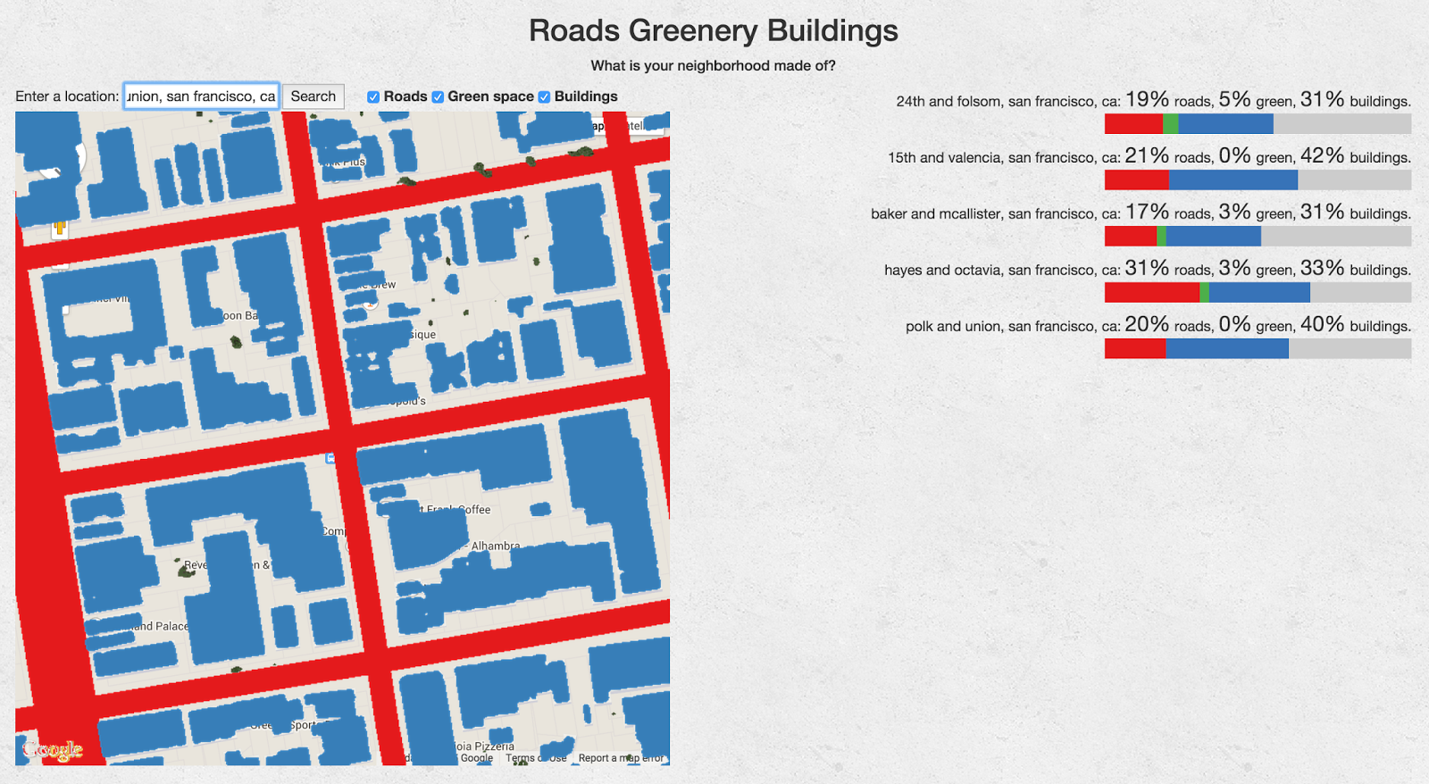
Here’s a comparison of some neighborhoods in San Francisco, based on some coffee shops I like. The first one is in the greenest area (24th st. in the Mission is full of trees) but greenery is in short supply all around. This is to be expected; it’s a big city. I was surprised to find Hayes Valley (#4) to have so many roads nearby, but on reflection, there are a couple of big boulevards right there. Meanwhile, the area around the north Mission (#2) and Polk (#5) look the densest in terms of buildings.
This doesn’t tell you everything, of course. The space calculations are imperfect, and there’s no description of what the green space is (a highway median is not the same as a nice park, even though they’re both green) or what the buildings are (a parking garage, a house, and an office skyscraper all get the same weight). But it’s a start. I think of this (or, you know, the platonic ideal of this) as a peer to Walkscore: by no means the only tool that helps you understand a place, but one of many. What’s good? Depends on you, I guess, but I think this tool shows how places with more buildings tend to be more approachable and interesting, while green space often just makes things farther apart.
Hat tip to Andrew Alexander Price for the blog post that inspired this work. (More details.)